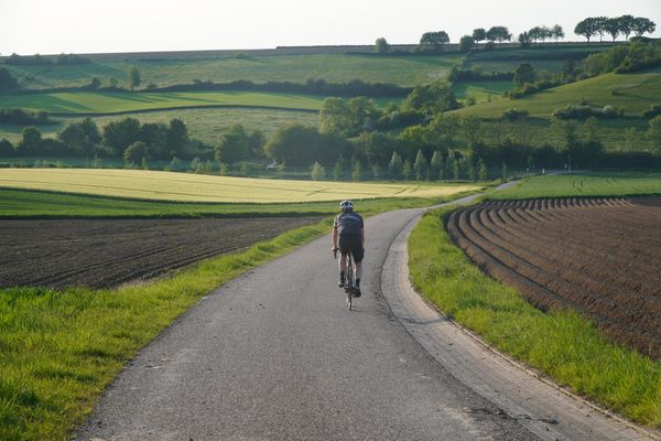
Road Cycling Routes near Gulpen
Discover the best road cycling routes near Gulpen in South Limburg, Netherlands. We've curated 13 road cycling routes within riding distance of Gulpen. The area offers hilly terrain. Each route includes GPX files, detailed elevation profiles, highlighted climbs, and recommended café stops along the way.
13 routes
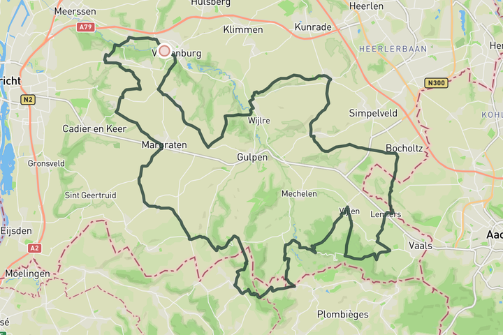
Unkown climbs in South Limburg
This route with unkown climbs still packs over 1000 meter of climbing in less than 80 kilometers. Things start of with a passage through the Mathieu van der Poel Allee, which got it name after the memorable victory of MVDP in 2019. From there you'll hit climbs like Hoebesweg, Loorberg, Groenenweg, Rugweg after which you briefly cross into Germany for the Lemierser climb. Back in the Netherlands you don't take the Eyserbosweg but instead take the Eyserweg up the Trintelerberg, a friendly alternative. From there you ride towards Stokehm to tackle the steep and short Doodeman Climb, which is the final challenge of the day.
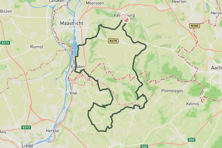
Visit to the Abbey of Val-Dieu
This route’s main attraction is the Abbey of Val-Dieu, which means a quick hop across the border into Belgium. Starting from Valkenburg or Gulpen, you’ll cross into Belgium early on and climb a few hidden gems like Hagelstein and Mabrouck before dropping down to the Abbey. It’s a great mid-ride stop, whether you're after a cold beer, a coffee, or a soft drink. Just keep in mind there's still about 45 kilometers left on the route. On the return leg, the climbing continues with Côte de Rosmel, Les Waides, and La Heydt. The Altenbroek climb gets you back into the Netherlands, and the Bemelerberg wraps it all up before your final descent into Valkenburg.
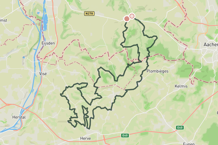
Hello Belgium
This ride takes you deeper into the Belgium Voerstreek and beyond. The roads here are quieter and the terrain is never flat. We counted over ten solid hills to tackle on this ride.
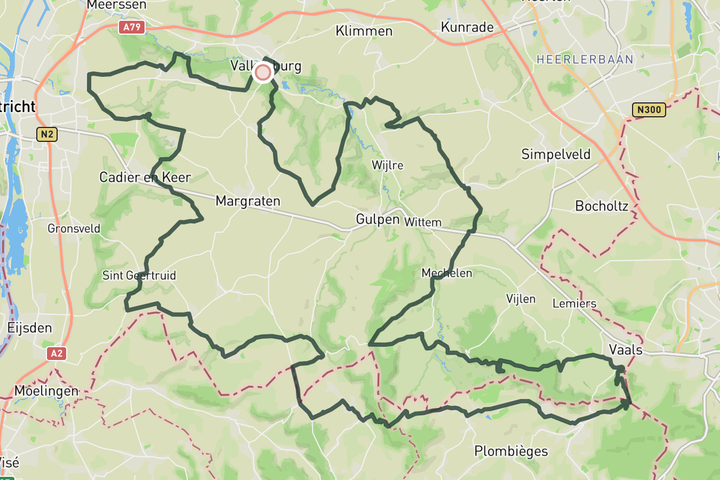
Highest point of the Netherlands
Starting out in Valkenburg, you’ll warm up right away with the Cauberg before settling into a few gentler climbs like the Geulhemmerberg and Belmelerberg. The route gradually steers you toward the Voerstreek, then up to the highest point in the Netherlands approached from the Belgian side. The ride back brings a series of challenging climbs: Epenerbaan, Eperheide, Kruisberg, Eyserbosweg, Fromberg, and the big finish on the Keutenberg.
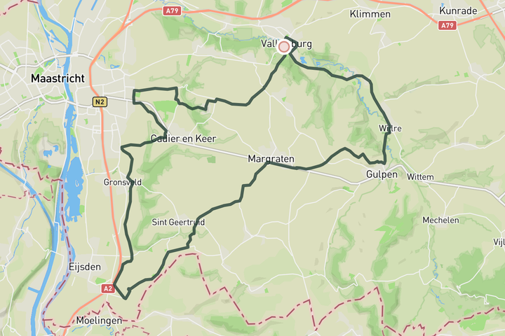
Mescherberg Loop
This route is an ideal first taste of the Heuvelland region. It starts in Valkenburg with the Daalhemerweg, a climb that’s steady but not too demanding. From there, the ride follows the edge of Maastricht, taking you up to Cadier en Keer, past the Gronsveld windmill, and along quiet paths toward Mesch. After the Mescherberg, the route winds through small hamlets on the way to Margraten. From Margraten, you descend into Gulpen before finishing on flat roads back to Valkenburg.
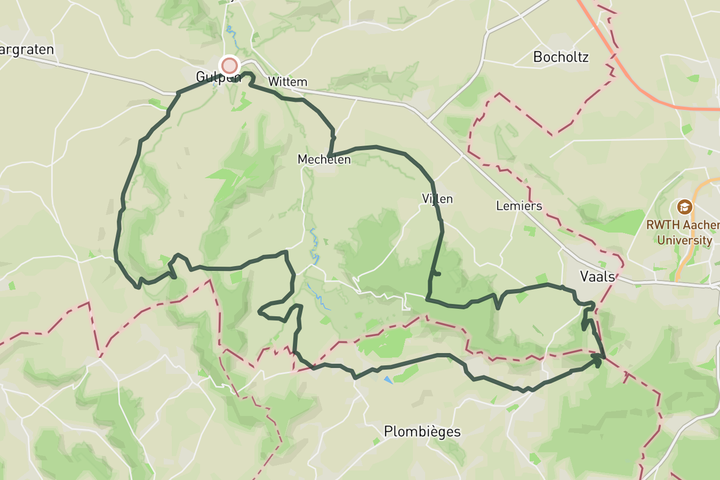
Coffee at 't Hijgend Hert
The title says it all — this one’s a perfect coffee ride. You’ll roll from Gulpen towards Slenaken, climbing the Loorberg before skipping the Camerig in favor of the Belgian side of the Vaalsberg. After a descend into Vaals, the Epenerbaan climb leads you up to 't Hijgend Hert for a well-earned coffee and a slice of apple pie. On the return, you’ve got a choice: test your legs on the Gulperberg from Partij or keep it easy and roll around it.
Sign up for free to see all 13 routes for South Limburg
Already have an account? Log inSign up for free to see all 13 routes
Get access to the map, filters and routes.
Other areas in South Limburg
Plan Your Visit to South Limburg
Discover where to stay, climbs, routes, bike rentals, cafes, and everything you need to plan your cycling trip in the South Limburg Guide.