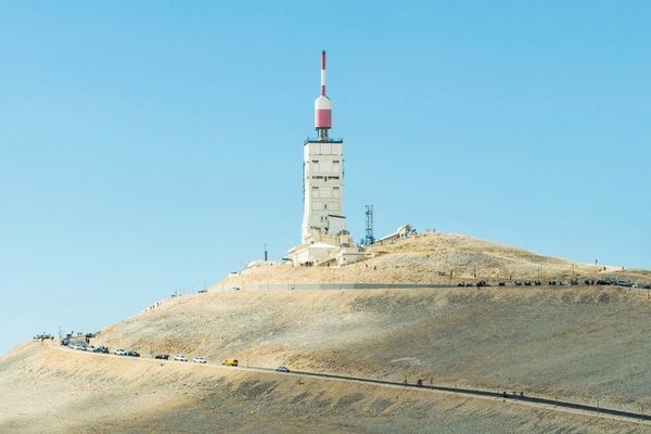
The Best Road Cycling Routes in Mont Ventoux
Discover the best road cycling routes in Mont Ventoux, France. Our curated collection includes 12 handpicked road cycling routes, from shorter coffee rides to challenging all-day rides. The region offers mountainous terrain, perfect for climbers seeking challenging ascents and dramatic elevation gains. Each route includes GPX files, detailed elevation profiles, highlighted climbs, and recommended café stops along the way. Browse the cycling routes map below to find your next ride, or use the filters to narrow by distance, elevation, and difficulty.
12 routes
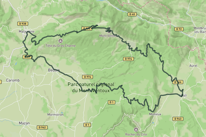
Mount Ventoux from Sault descending by Malaucène
A big loop that starts with the gentle Sault approach to Ventoux. You ride most of the way at a comfortable gradient before joining the steeper final stretch near Chalet Reynard. The descent toward Malaucene is varied and fast. From Malaucene you cross Col de la Madeleine and drop through Bedoin, then take the Route de la Gabelle back toward Sault. That last stretch is rolling and forested, with a viewpoint at the Belvedere de la Gabelle before you drop back into town
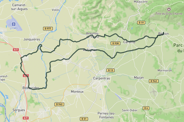
Into the Provence countryside
This route rolls out of Bédoin and drifts into a completely different landscape, leaving the slopes of Ventoux behind for open farmland and quiet, flat roads. It passes through a string of small towns and villages like Aubignan and Sarrians, where the pace slows and the riding becomes more about flow than effort. As the route stretches further west, it brushes sections near the l’Ouvèze, with long straight lines through vineyards, orchards and fields framed by cypress trees. The terrain stays mostly gentle, making it ideal for steady riding, while the constant views of Ventoux in the distance keep a quiet connection to the mountain.
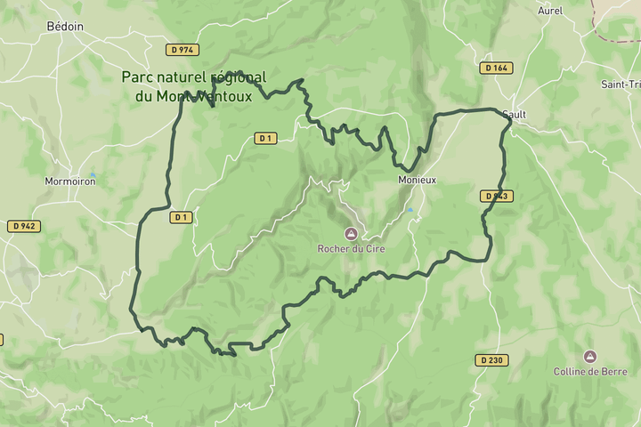
Vineyards and lavender fields of the Provence
A mellow day exploring the quieter roads south and east of Ventoux. From Sault you head toward the Belvedere de la Gabelle and along the Route de la Gabelle through forest and open plateaus. The riding is steady and unhurried. Past Flassan the road drifts through vineyards, orchards, and small villages toward Villes-sur-Auzon and Methamis. The climb over Cote de Saint-Hubert adds some structure without being demanding. Ventoux's bare summit appears in the distance at several points before the route loops back to Sault.
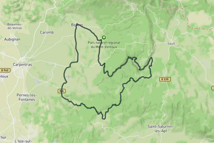
Cols de la Ligne, Murs and Gorges de la Nesque
From Bedoin you head out toward Venasque, then climb Col de Murs and Col de la Ligne back to back. Neither is steep, and both are quiet, so you settle into an easy rhythm away from the busier Ventoux roads. From Monieux you join the Gorges de la Nesque, where the road cuts through limestone cliffs with big exposed sections and views down into the canyon. The return toward Flassan and Bedoin is faster and more flowing. The gorge section alone makes this loop worth doing.
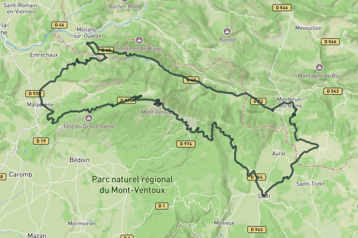
Sault - Ventoux loop return via Toulourenc
Tackle the Ventoux right from the start and descent down to Malaucène. From there take the road north of Ventoux that follow the Toulourenc river to guide you back home. This route also works perfectly in opposite direction if you want to tackle the other side of the mountain.
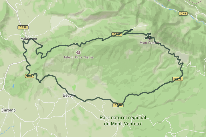
Mount Ventoux from Malaucène descending by Bèdoin
You start with Col de la Madeleine from Bedoin as a warm-up, a short and easy crossing to Malaucene. From there it's the irregular Malaucene climb, where the gradient keeps changing and you never quite find a rhythm before the exposed upper slopes. The descent to Bedoin is fast and direct, especially through the forest where the road invites speed but the bends demand attention.
Sign up for free to see all 12 routes for Mont Ventoux
Already have an account? Log inSign up for free to see all 12 routes
Get access to the map, filters and routes.
Routes by area
Plan Your Visit to Mont Ventoux
Discover where to stay, climbs, routes, bike rentals, cafes, and everything you need to plan your cycling trip in the Mont Ventoux Guide.