Road Cycling Routes near Saint-Jorioz
Discover the best road cycling routes near Saint-Jorioz in Annecy, France. We've curated 13 road cycling routes within riding distance of Saint-Jorioz. The area offers mountainous terrain. Each route includes GPX files, detailed elevation profiles, highlighted climbs, and recommended café stops along the way.
13 routes
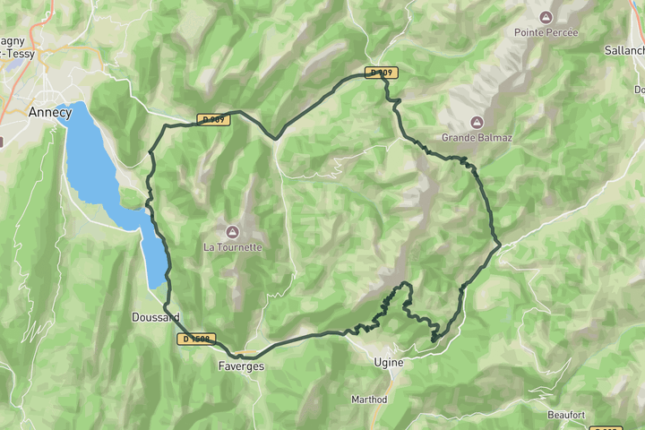
Cols de l'Arpettaz and Aravis
102.8 km • 2247 m • Hard
This is one of the bigger mountain routes around Annecy, linking the long climb toward Col des Aravis with the far more irregular and demanding ascent of Col de l'Arpettaz. The route initially follows the lake before you head into the open landscape of the valleys around La Clusaz and Flumet. The Aravis brings a steady rhythm and bigger mountain scenery, while Arpettaz feels much rougher and quieter once the road narrows and the famous hairpins begin stacking across the hillside. The contrast between both climbs gives the ride its character, mixing smoother high mountain roads with a more isolated and old fashioned alpine feel.
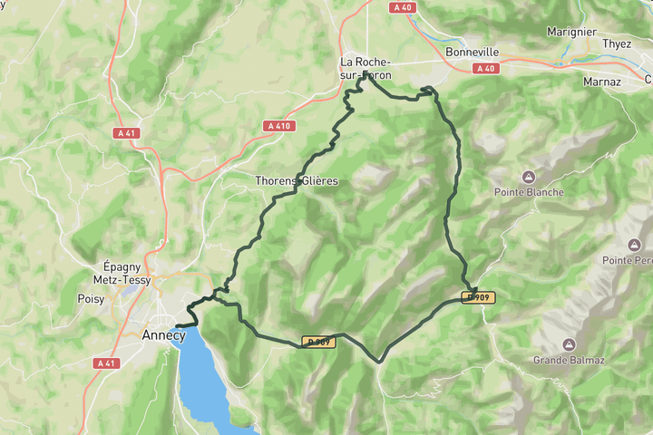
Tour des Glières
87.4 km • 1438 m • Moderate
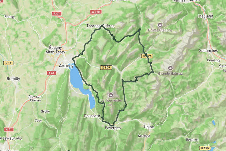
This route leaves Annecy through quieter rolling roads before heading toward Thônes and Saint-Jean-de-Sixt beneath the larger peaks of the Aravis massif. The route circles the mountains through a constantly changing mix of valleys, forested sections and open farmland as it passes through La Roche-sur-Foron and Thorens-Glières. The terrain changes constantly throughout the day, alternating between steady drags, faster valley roads and shorter climbs without ever settling into one long ascent. It feels exploratory and varied from start to finish, with a strong sense of moving continuously through different landscapes before returning toward the lake.
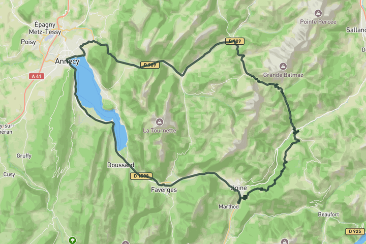
Col de Aravis loop
113.8 km • 1915 m • Hard
Starting from Saint Jorioz, this route follows the lake north toward Annecy before gradually heading into the valleys beneath the Aravis massif. The roads stay fast and flowing through Thônes and Saint Jean de Sixt, with the larger mountain scenery building steadily as the route approaches Col des Aravis. The climb itself feels consistent rather than overly steep, opening progressively toward wider alpine views near the summit and the surrounding peaks above La Clusaz. After the pass, the route descends through longer valley roads and quieter sections before eventually returning toward the lake, giving the ride a smooth rhythm despite the distance.
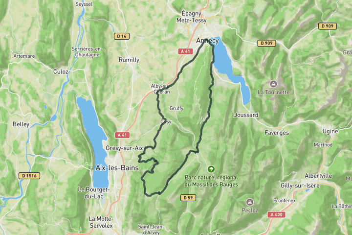
Loop to Mont Revard
90.6 km • 1761 m • Hard
This is a long endurance day that trades the busy lakefront of Annecy for the quiet solitude of the Bauges massif. You start with a gentle climb toward Col de Leschaux, navigating through open farmland and short stretches of forest that keep the gradient manageable. You hit the real work once you turn toward Col de Plainpalais, where the road pushes steadily upward through dense trees. Continue towards the top of Mont Revard where the terrain opens up as you reach the high alpine pastures near the top. Consider a small detour to enjoy the views over Aix-Les_bains and Lac du Bourget before taking the descent down the valley and towards Annecy.
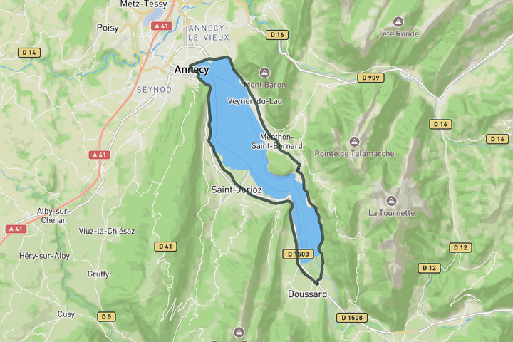
Around Lake Annecy
37.4 km • 219 m • Easy
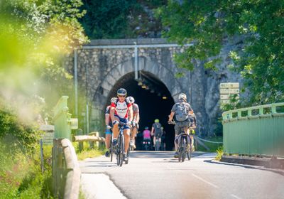
The cycling loop around Lake Annecy is usually the first ride road cyclists tackle upon arriving in the region, with many local routes relying on sections of its famous lakeside cycle path. The exceptionally smooth roads and dedicated infrastructure make the 38-kilometer circuit accessible to everyone, from casual touring cyclists to riders gearing up for major alpine passes. While the loop works well in either direction, riding clockwise is widely considered the optimal choice for better water views and smoother traffic flow. Departing clockwise from Annecy positions you in the lakeside lane, offering uninterrupted views across the lake toward Mont Veyrier. This direction also lets you tackle the route's main elevation early on, rolling through undulating terrain near Menthon-Saint-Bernard and powering up the short, punchy climb to the Talloires Belvedere while your legs are still fresh. The southern and western legs transition into fast, flat terrain as you spin through the tranquil Bout-du-Lac nature reserve and join the Voie Verte. Built along a former railway line through Duingt and Sévrier, this smooth, traffic-free greenway bypasses vehicular traffic entirely. With constantly changing views of shoreline villages and mountain walls, it delivers a perfectly balanced, seamless finish back into Annecy.
Sign up for free to see all :count routes for :destination
Already have an account? Log inSign up for free to see all 13 routes for Annecy
Get access to the map, filters and routes.
Other areas in Annecy
Plan Your Visit to Annecy
Discover where to stay, climbs, routes, bike rentals, cafes, and everything you need to plan your cycling trip in the Annecy Guide.