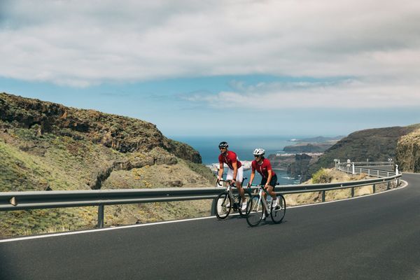
Road Cycling Routes near Vecindario
Discover the best road cycling routes near Vecindario in Gran Canaria, Spain. We've curated 6 road cycling routes within riding distance of Vecindario. The area offers mountainous terrain. Each route includes GPX files, detailed elevation profiles, highlighted climbs, and recommended café stops along the way.
6 routes
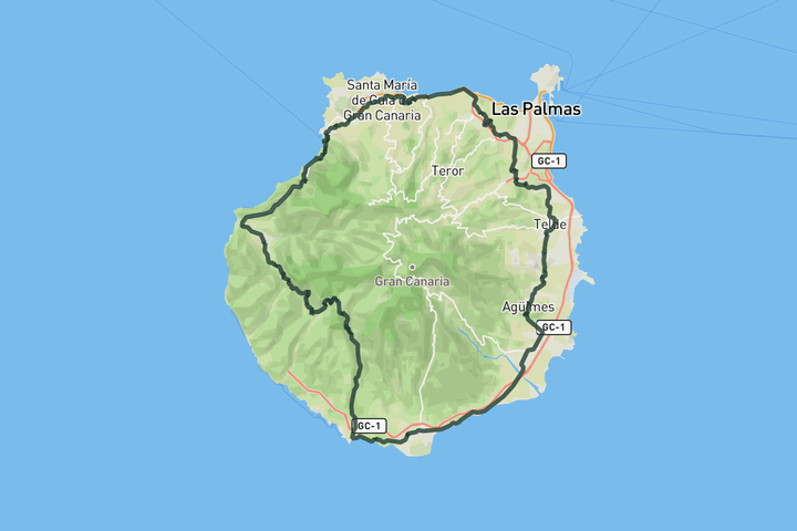
Full loop around Gran Canaria
f you want to circle the volcano on Gran Canaria, then this one is for you. This epic route is a real challenge and should not be taken lightly. You can start basically anywhere on the loop and ride in either direction, but our route starts in Maspalomas so that you can get the hardest part out of the way first.
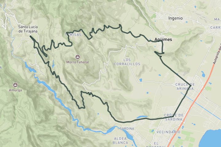
Guriete Canyon
Like any loop on Gran Canaria, the scenery is spectacular from start to finish. You climb steadily up to Temisas, reaching the village after about 20 kilometers. From there the ride turns into a long and flowing descent on winding roads through the beautiful Guriete Canyon.
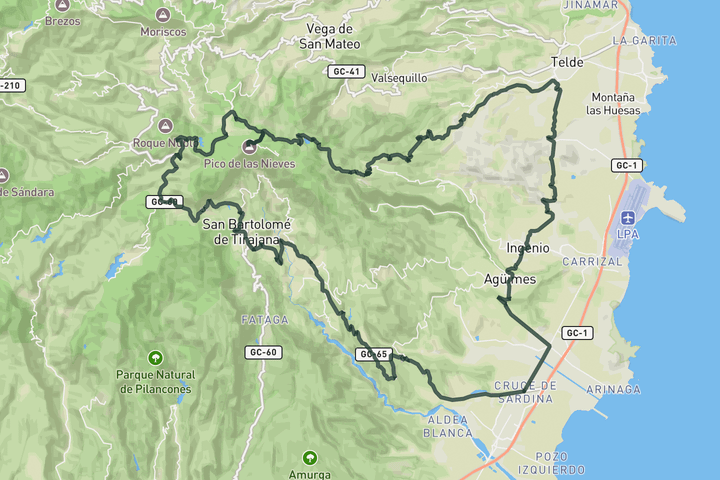
Pico de las Nieves loop
This route from Vecindario takes a long inland approach that is perfect for a steady warm up before the road starts to go up near Telde. From there it's a long steep climb through cultivated hillsides and pine forest toward the Pico de las Nieves, the island’s highest point. Reach the summit, take a breath, and enjoy a beautiful descent all the way back down to the coast.
Risco Blanca and Guayadeque Gorge
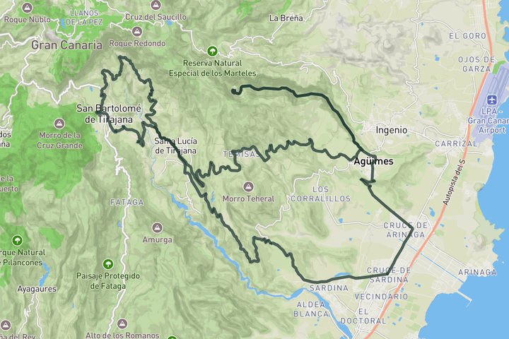
This route from Vecindario climbs quickly toward Santa Lucía de Tirajana and then turns inland on the GC‑65, rising through terraced farmland and dry barrancos framed by low hills. After Santa Lucía you leave the main road for the narrow lane to Taidía, where the road hugs the edge of the ravine beneath the striking white face of Risco Blanco, a dramatic cliff that towers above the valley. From there you continue through peaceful countryside to San Bartolomé de Tirajana and then drop back toward the GC‑65 before branching off onto the panoramic road toward Temisas and into Agüimes. Before heading back to the coast turn left into the Guayadeque Gorge for a spectacular climb ad that threads into the deep gorge, rising between high rock walls.
Coast to Top loop
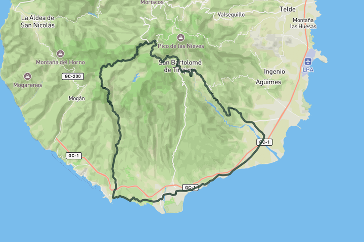
This coastal to volcano loop starts in Maspalomas and takes you west towards Santa Águeda. From there, it turns inland and follows the Arguineguín valley at an easy, steady pace. Here the road start to go up and what follows is a long and demanding climb. It pitches up sharply as you ride past volcanic walls and into pine forest on the way to Cruz de San Antonio. This is the toughest part of the route. Keep climbing until your reach Ayacata, the highest point of the day. From there a fast descent through San Bartolomé and Santa Lucía follows. Soon after, the road leads you into the dramatic red rock gorge of Guriete. Once you roll into Vecindario, you are set up for the final stretch along the coast, which brings you back to Maspalomas.
Telde and Bandama from Vecindario
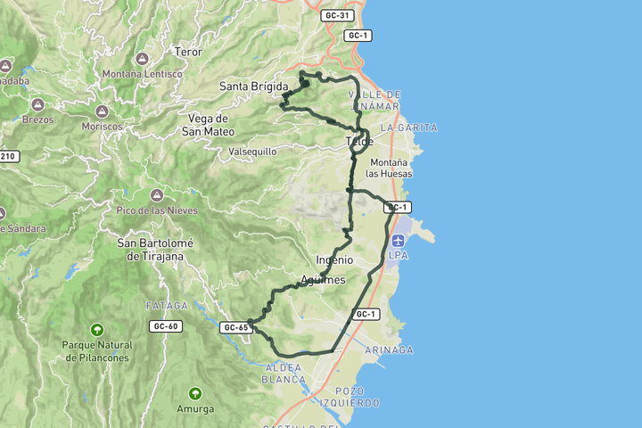
This loop from Vecindario winds north through Carrizal and across the low hills toward Telde, reaching the outskirts before turning inland to Marzagán and the climb to Bandama. The road rises past vineyards and stone walls to the edge of the vast volcanic caldera, with sweeping views over the island’s east coast and central highlands. The descent drops into the old centre of Telde, where cobbled streets, historic buildings and palm-lined plazas offer a glimpse of the island’s colonial past. From there, the route continues through Ingenio and Agüimes, then climbs the panoramic GC‑551 toward Lomo de Malpaso, before descending back to Vecindario.
Sign up for free to see all 6 routes for Gran Canaria
Already have an account? Log inSign up for free to see all 6 routes
Get access to the map, filters and routes.
Other areas in Gran Canaria
Plan Your Visit to Gran Canaria
Discover where to stay, climbs, routes, bike rentals, cafes, and everything you need to plan your cycling trip in the Gran Canaria Guide.