- What Matters in a Cycling Navigation Device
- Bike Computers: The Gold Standard for Cycling Navigation
- Smartwatches: Fine as a Backup
- Phone Apps: Navigate Without Extra Hardware
- Which cycling navigation app to use
- Don't Skip the Bike Phone Mount
- Which Navigation Setup Should You Choose?
- Navigating on a Cycling Trip
- Ready to Ride
You've found the route you want to ride. Maybe it's a new loop from your front door, or the climb to Sa Calobra on your next trip to Mallorca. Now you need to follow it without stopping at every junction.
If you've read How to Plan Road Cycling Routes in Places You've Never Been, you've saved your GPX file. This article picks up from there.
You have three options: a bike computer, a smartwatch or a phone app. Here's how they compare, which one to choose, and what to sort out before a cycling trip.
What Matters in a Cycling Navigation Device
Whatever option you choose, judge it on these points:
- A screen you can read at a glance. On a fast descent or in full sun, you get a split second to look, not five.
- Offline maps. Mobile signal isn't guaranteed in the mountains or on remote roads.
- Battery for a full day. A long day in the Dolomites can mean seven hours or more in the saddle.
- Easy GPX import. Your planned route should load in a few taps.
- Rerouting. Missing a turn shouldn't ruin the ride. Your device should get you back on track.
- Climb previews. Knowing how much is left helps you pace the climb.
Bike Computers: The Gold Standard for Cycling Navigation
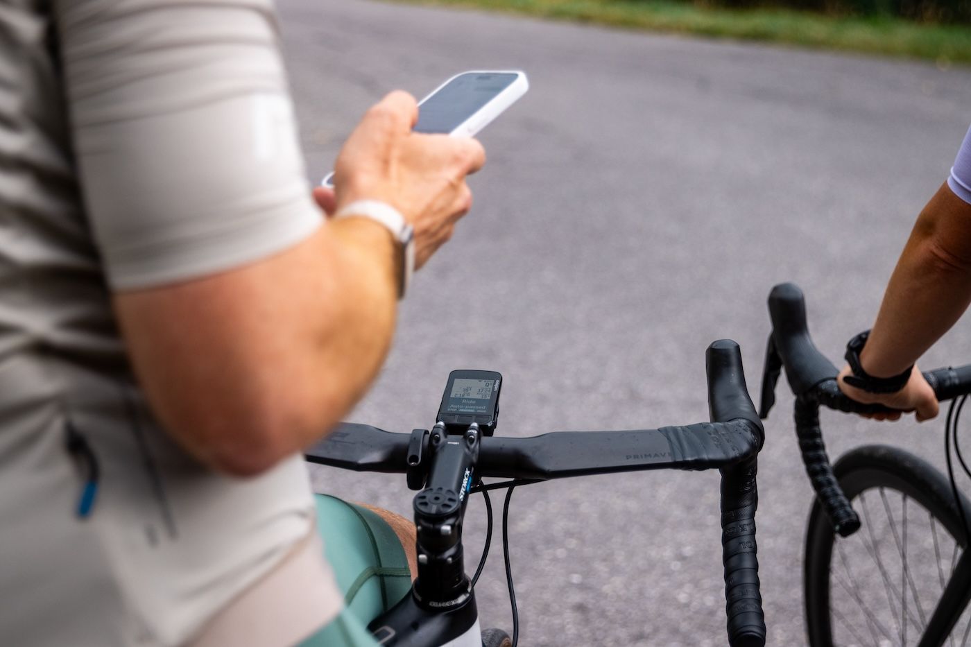
A bike computer is built for one job: showing you the way while you ride. The screen sits right where your eyes go, it's made to be read in sunlight, and the buttons work with gloves on.
If you ride a lot, you probably already own one. For everyone else, it's the upgrade that makes a big difference to how you navigate.
If you don't have one yet, these are the main brands to look at:
- Garmin: the deepest feature set and the biggest range, from compact to large-screen models
- Wahoo: simple to set up and easy to use (my personal favourite)
- Hammerhead: large, sharp touchscreen and strong map display
- Bryton: the budget option, with solid basics for less money
The downside is price. A good bike computer costs you between €200 to €800, and not everyone wants to spend that before a first trip.
Battery life is rarely a problem anymore. Most models last a full day of riding, and some models even have solar charging built in.
Smartwatches: Fine as a Backup
A GPS smartwatch like a Garmin Fenix or an Apple Watch can guide you along a route. The problem is the screen. On your wrist at 30 km/h, it's too small to read a map, so you rely on vibrations and beeps to tell you when to turn.
That works on a simple route with a few clear junctions. It gets harder in a busy urban areas or on a descent with three turns in a row.
Some riders get around this by mounting the watch on their handlebars. Garmin even sells a QuickFit Quarter-turn Bike Mount for it. Smartwatches can be a great help, but it's still a small screen compared to a bike computer.
If you already own a smartwatch, use it for the turn alerts or roads you are familiar with. For the map, you want something bigger.
Phone Apps: Navigate Without Extra Hardware
Your phone has the biggest screen of the three, and you already own it. That makes a cycling navigation app the easiest way to start, without buying a bike computer or a watch. Plenty of riders navigate this way simply because they'd rather spend the money on other cycling gear. Some riders even use it as a second navigation device either on their handlebar or in their backpocket.
There are trade-offs:
- Battery: GPS navigation drains your phone fast, so bring a power bank on long days.
- Sunlight: phone screens aren't always made for bright outdoor light.
- Layout: every app looks different, and which one works best is down to personal taste.
Where you mount the phone matters even more than with a bike computer. Close to the stem, a phone screen is harder to read at a glance. Further forward on the bars, it sits much closer to your line of sight.
Which cycling navigation app to use
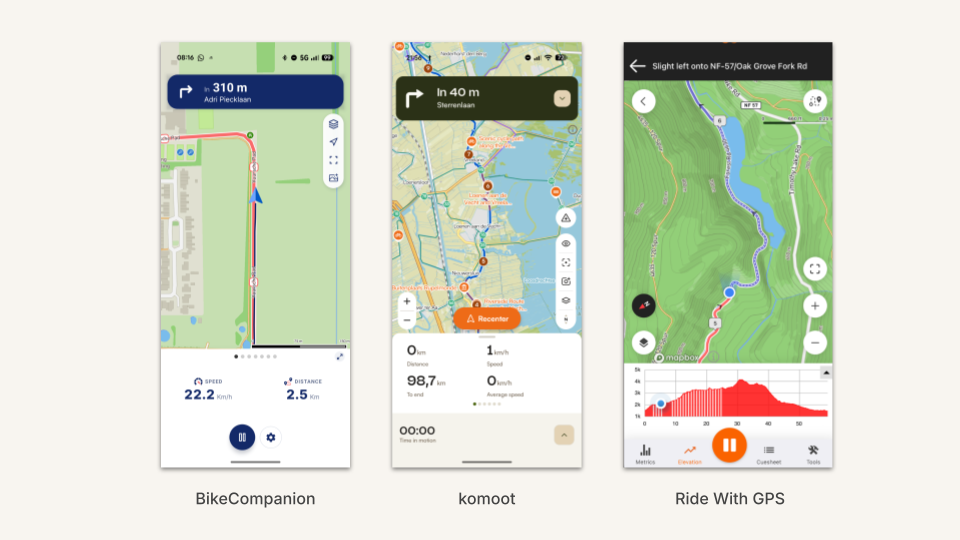
Komoot, Ride with GPS and BikeCompanion all cover the basics: turn-by-turn directions, voice navigation and offline maps. Any of the three will get you around roads you've never ridden.
Komoot and Ride with GPS are best known as route planners with navigation built in. BikeCompanion turns you phone into a powerfull customizable gps device with support for Bluetooth sensors like heart rate, power and cadence. Its settings let you set up the navigation screen your way: 2, 4 or 6 metrics in view, your preferred zoom level, fixed map orientation and more.
All three let you import a GPX file, so you can follow a route from anywhere, including the curated routes in our destination guides.
Don't Skip the Bike Phone Mount
If you mount an expensive phone on your handlebars, it has to stay on the bike. Rough tarmac, cobbles and a pothole on a descent will test any mount. These options are truly tested and are recommended:
- Quad Lock is the best-known option. It's very secure, but it needs its own phone case or an adapter stuck to the back of your phone.
- Loop clamps your phone as it is, with no special case needed. It's simpler, and it looks cleaner on the bike.
Other mounts exist, but they usually trade sturdiness or looks for a lower price.
Which Navigation Setup Should You Choose?
If you ride regularly or travel for cycling, a good bike computer is the best navigation setup you can get. It's built for the job, lasts all day and stays readable in any light.
A phone or smartwatch is a good alternative, but not a full replacement. Both get you around, and they're a smart way to start without spending money on extra hardware. On long or complex days, though, you'll notice the compromises.
|
Setup |
Best for |
The compromise |
|---|---|---|
|
Bike computer |
Anyone who rides regularly or travels for cycling |
Price |
|
Phone app and mount |
Getting started, occasional trips, or as a backup |
Battery, sunlight and a mount you can trust |
|
Smartwatch |
Turn alerts, or as a backup |
A screen too small to read a map |
Navigating on a Cycling Trip
At home you know every road and turn. On a trip, your device does all the thinking, so a little prep goes a long way.
- Download offline maps. Signal can drop in the mountains, and roaming data isn't free everywhere. Switzerland and the UK, for example, aren't covered by EU roaming.
- Load your routes before you go. Importing GPX files on hotel wifi the night before your first ride is no fun.
- Pack every cable. Your bike computer, phone and lights all need charging after a long day.
- Bring your own mount. Rental bikes rarely come with one. We cover this in Your Own Bike or a Rental.
Our road cycling holiday packing list covers everything else to bring.
Ready to Ride
Whatever you navigate with, it's only as good as the route you load. Every destination guide on The Ride Atlas comes with curated routes you can download as GPX files, ready for your bike computer, watch or phone.